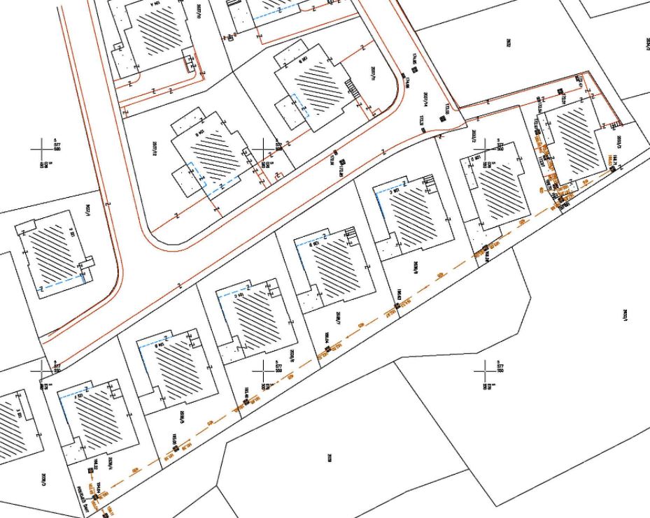
Nakon stupanja na snagu Zakona o državnoj izmjeri i katastru nekretnina ( NN 112/18, prosinac 2018 ) osniva se Katastar infrastrukture i vodi na temelju evidencija koje su za pojedinu vrstu infrastrukture dužni u skladu s tim Zakonom osnovati i voditi vlasnici odnosno njihovi upravitelji. U katastru infrastrukture vode se podaci o vodovima i pripadajućim objektima elektroenergetske, elektroničke komunikacijske, toplovodne, plinovodne, naftovodne, vodovodne i odvodne Podaci o položaju infrastrukture i pripadajućih objekata iskazuju se koordinatama (E, N) u ravninskoj kartografskoj projekciji HTRS96/TM, a podaci o visinama (H) u referentnom visinskom sustavu Republike Hrvatske HVRS71.
Geodetic study of infrastructure is made in the case of:
recording of newly built and / or unregistered infrastructure
changes in position data on existing infrastructure and data on basic technical characteristics of infrastructure
leaving the existing recorded infrastructure
leaving the existing recorded infrastructure and
change of descriptive data on the existing recorded infrastructure kept in the infrastructure cadastre.
The geodetic study of infrastructure must contain the following:
data on the existing recorded infrastructure on the border of the area covered by the study
new data on the location of infrastructure and associated facilities
identification number of the infrastructure and associated facilities, if specified
new data on the type and basic technical characteristics of the infrastructure and associated facilities, data on the owner or manager of the infrastructure, data on the current use of the infrastructure and associated facilities and
accuracy of determining data on infrastructure and associated facilities